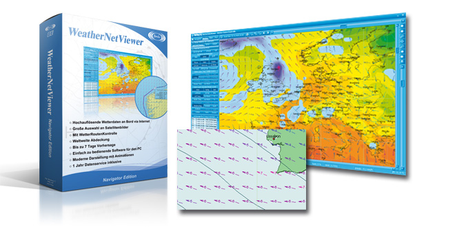
Weather on board from the Internet
WeatherNetViewer is a very easy to use Weather Software, which uses weather data off the Internet (www.meteoserver.net). Many innovations / improvements are integrated, making an evaluation of the meteorological data even simpler and more precise, e.g. in the form of impressing animations. If you can live without an SSB-radio and you have access to the Internet, WeatherNetViewer is an attractive alternative.
- Easy to use and modern Weather Software
- Small Data packets which can be individuallys combined
- World wide coverage
- Intuitive representation of the Weather data with animations
- Easily understandable symbolic
- including background world maps
- Large selection of Satellite Images
- Modern and flexible User interface
- free Online-Updates
- optional Weather Route Control (Weather Routing)
The access to the weather data is already fully integrated in the program. This allows you to download the weather data in seconds to your PC, and to view it offline for days. This is ideal for users who may not always have an internet connection, or who are using a mobile or satellite phone, as the data is just downloaded once in a new highly compressed format called MSD.
IMAGE
With WeatherNetViewer you get world-wide high resolution forecast information (0.1 degree raster; up to 7 days forecast in 1 hour Steps) allowing you to plan a safe trip at any time.
You will get all necessary data:
- Wind: Strength and Direction (10m and Sea Level)
- Wave: Height and Direction
- Barometric Pressure: at Sea Level
- Air Temperature: 2 m above ground
- Cloud Cover: Altitude and Ceiling
- Precipitation: by Type
- Relative Air Humidity
- Water Temperature
- Convective Clouds
- Waves: 1st and 2nd Swell and Direction
- Precipitation: Rain, Snow, Fog, Snow Cover
- Primary Wave Period
- Primary Wave direction
- Secondary Wave period
- Secondary Wave direction
WeatherNetViewer can download the weather data even automatically – timer controlled. The meteorological data will be processed immediately and presented in the Software. That is much more efficient than surfing many different web sites. The size of the weather data file of the western Mediterranean (see image) is only 120 KB “small” and could be downloaded even with an iridium phone. It uses the latest internet technologies to deliver the Data in a flexible and efficient way.
Ausschnitt westliches Mittelmeer
click image to enlarge
The integrated Download manager opens the Internet connection and starts the download. After the successful download the Internet connection will be closed immediately and the weather data will be computed “offline” on your Computer.
Bonito NetManager
Easy to use
In contrast to other weather systems the presentation of the meteorological data is very intuitive and presents the data in a very simple and uncomplicated way – just as you’d expect it from a modern software. With only one mouse-click you will get all forecast values in plain text. The global background map is of course included in the software.
zum vergrößern anklicken
click image to enlarge
Synoptic data (measured actual values)
WeatherNetViewer can synoptic data as well. Synopsis data are measured values and the foundation of all predictions. These data indicate the values that have surrounded and you actually surrounded you.With these Data you are in a position to verify the forecast data by yourself. You can download the synoptic data from the last 7 days. This is interesting for the use of digital logbooks such as TripCon.
WeatherNetViewer Synop ungerastert Bonito WeatherNetViewer Synop gerastert
click image to enlarge
Satellites images
You can access a large selection of satellite pictures. In addition there is a special selection of satellite images which are suitable for animation. The past weather runs as an animation on your screen, while you can change the presentation, zoom or shift . Remarkable is the special type of animation: an image transformation process creates an extremely brilliant picture of the slide show .
Meteosat 8 Bild (zum vergrößern anklicken)
click image to enlarge
NOAA Satellitenbild (zum vergrößern anklicken)
click image to enlarge
The Software
The WeatherNetViewer visualizes all data and satellite images. The presentation of different parameters can be combined. The remarkable thing is the extreme fine resolution of the pictures. With the new “zoom slider” you can zoom in and out a selected area.
Zoom Slider (zum vergrößern anklicken)
click image to enlarge
The symbols and representations are adapted to modern times to get a quick overview. We deliberately did not include outdated meteorological “cryptology” as Wind feathers from the early 20th century. These signs are completely unnecessary in today’s technology. You should not have to study meteorology to be able to understand the general weather situation. With the current technology and graphic capabilities of WeatherNetViewer it is much easier to analyze complex meteorological data.
Navigator Edition (Meteo-Route-Control / Weather routing)
You can create the planned route on a map similar to a navigation map*. MeteoCom calculates the weather data using the journey’s estimated time and colors the planned route according to the weather situation. Thus you can see easily when, at what time, and on what route section unfavorable weather conditions will be expected. The route can be modified and exported, if necessary. This feature is meant to control a route realistically, using a GPS, from the meteorological site. With a simple click on the “Play” button the sailing trip will be animated as a movie. A weather data overlay on navigation charts is therefore completely unnecessary.
Bonito WeatherNetViewer Navigator
click image to enlarge
* There is no guarantee for the timeliness and accuracy of the charts is taken.
4 times a day “fresh” Weather
Forecasts are generally run four times a day, and the MeteoServer system will be updated every 6 Hours as well. However for you it’s normally not necessary to update the Data so often.
What’s in the Box
The purchase price contains both the software and a 12 months weather data subscription for the MeteoServer, starting on the date you first registered the Software.
This subscription ends automatically, if not renewed by you!
Where to buy
BONITO WeatherNetViewer is being distributed by a number of companies world wide. For details on obtaining and using WeatherNetViewer, contact your local Dealer or refer to Bonito’s Dealer Website.
Minimum requirements
Intel Pentium M with 1 GHz or higher, Windows 10, 8, 7 & Vista, 1 GB RAM, Graphic with 32 Bit Color and 1024×600 Resolution, Internet connection.
Upgrades
You can upgrade this MeteoCom 6 Internet Edition at any time to MeteoCom 6 standard or marine edition.